NOAA Grants Marouane Temimi Funding to Improve Mapping of River Ice
 Marouane Temimi, Gallaher Associate Professor in the Department of Civil, Environmental and Ocean Engineering at Stevens, is hot on the trail of a new way to monitor river ice.
Funded by the National Oceanic and Atmospheric Administration (NOAA) through the Cooperative Institute for Research to Operations in Hydrology (CIROH), this latest project, “Augmenting River Ice Monitoring Capabilities Using Radar Imagery to Support Streamflow Forecast,” has the potential to significantly improve stream flow and flood forecasting across northern regions of the United States and Canada.
The study uses radar satellite imagery and advanced machine learning to track where river ice is forming, melting, moving and breaking up — even at night and under cloudy conditions.
“River ice plays a major role in winter flooding, but it’s one of the most difficult things for forecasters to observe consistently,” Temimi said. “Our goal is to provide reliable, timely information that helps communities prepare for ice-related flood risks before these situations escalate.”
Seeing river ice clearly — even in the dark
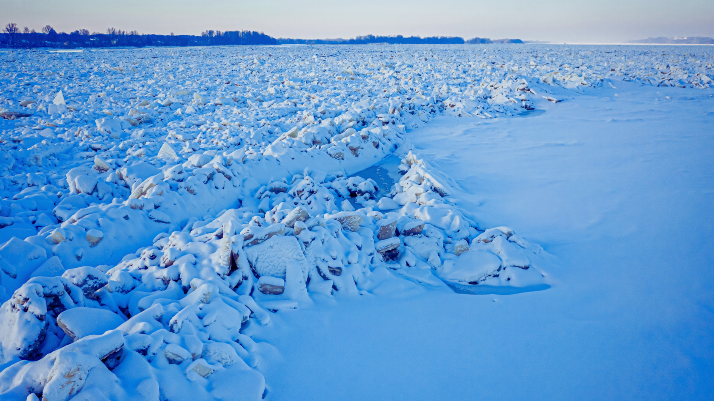
When river water becomes cold enough to turn into ice, and when that ice later begins melting and breaking apart, the resulting water flow disruption and ice blockages can rapidly raise water levels enough to flood surrounding areas. These seemingly unpredictable events often develop quickly, with no time for emergency response.
Forecasting river ice conditions has long been a challenge. The visible and infrared light used in traditional satellite imagery can’t see through clouds, operate at night, or even reliably detect ice in narrow rivers or tributaries where ice often forms first.
Temimi and his team, including Baya Cherif, Stevens Ph.D. student, and Hamza Kaddour, research assistant and data scientist, are taking a new view of the problem. They’re combining two types of satellite observations: satellite data from optical imagery, which captures surface characteristics similar to photographs, and synthetic aperture radar (SAR), an active sensing technology that measures its own reflected signals to penetrate clouds and darkness.
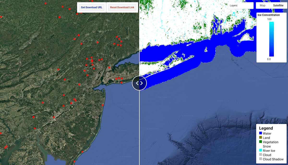 The project builds on the team’s success in developing an automated, near real-time river ice mapping system and public-facing portal. based on visible infrared imaging and deep learning to process the data. [BS1] The initial system, currently running in a cloud environment through CIROH, is being considered for full NOAA operational use.
The work is being conducted in the Stevens Integrated Spatial Modeling and Remote Sensing Technologies (I-SMART) laboratory. Using deep learning and data-fusion techniques, the researchers will generate high-resolution maps showing river ice extent, texture and movement throughout the northern U.S. and Canada. These maps will distinguish between ice conditions — such as thin sheet ice versus jumbled ice formations — and will extend monitoring to those previously obscure, smaller, narrower rivers.
The new work adds radar data, blending optical imagery and SAR into a single, more robust product.
Making river mapping as smooth as ice
Over the 17.5-month project, Temimi and his team will test the system across northern river basins and configure clear, accurate outputs to be integrated into national forecasting workflows, including NOAA’s streamflow modeling infrastructure.
By upgrading the modeling of icy conditions, such as how a certain amount of ice would affect the movement of water through rivers, the system could improve streamflow predictions during ice-affected periods and support earlier, more accurate flood warnings.
“This is a research-to-operations effort,” Temimi said. “We’re designing the system so it can transition smoothly into real-world forecasting environments.”
The project will also help train graduate students and postdoctoral researchers in cold-regions hydrology, remote sensing, and machine learning. The team will share tools, data, and training materials with the broader scientific and operational community through national workshops and open research platforms.
By strengthening river ice monitoring and forecasting capabilities, the work aims to increase resilience: for the decision-makers to have the information they need, when they need it, and for the northern communities to better withstand the impacts of ice-induced flooding.
Learn more about academic programs and research in the Department of Civil, Environmental and Ocean Engineering: