Stevens student researcher analyzes satellite images of rivers, lakes, ice and other features — helping key agencies like NASA, NOAA and USDA plan and prepare for floods, water shortages and other emergencies
Mohamed Abdelkader grew up in North Africa. But he studies ice for a living.
“It’s true,” laughs Abdelkader, a doctoral candidate in civil engineering who conducts research in Stevens’ i-SMART Lab. “On the other hand, Tunisia isn’t entirely a desert as people might think it is. Some parts actually get quite a lot of rainfall and snow.”
Abdelkader’s road toward a STEM doctorate began in his home city of Chebba.
“I remember clearly once how they were doing construction on the next street over from the one my family lived on, and then we expected they would do the next work on our street, which was in the same condition. It needed work. But that’s not what they did. They skipped our street.
“I immediately became interested in civil engineering.”
Protecting communities from floods, water shortages
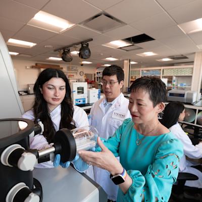
After obtaining bachelor’s and master’s degrees in Turkey, Abdelkader chose Stevens to cap his educational career. He selected Stevens specifically so that he could work directly with Professor Marouane Temimi, a leading national expert in hydrometeorology, water resources management, and remote sensing with multiple projects leveraging satellite imagery.
“He is amazing,” Abdelkader says of Temimi. “In addition to his obvious expertise in the field, he also treats his students exceptionally well. He helps us network — I already know a lot of people at NOAA, NASA, USDA, and elsewhere — but also understands that students’ lives are not simple.”
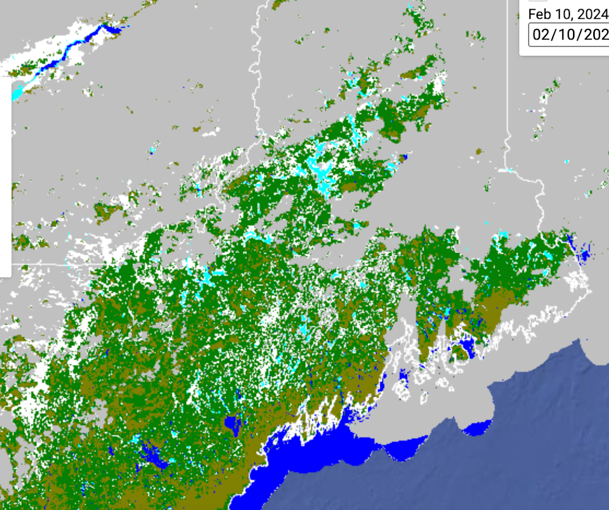
 The Ph.D. candidate’s current main focus is a project to inform flood prediction on a detailed local level in cold regions of the U.S. This involves examining rivers and lakes to determine their ice cover status, including identifying those that are frozen or undergoing melting, by incorporating analysis of freshwater freeze-up and break-up cycles.
Around 2 a.m. each morning during winter, Abdelkader goes to the i-SMART Lab and investigates maps from the Stevens River Ice Mapping System, an automated system that provides up-to-date information on ice conditions in rivers and lakes across the nation.
He then helps prepare a report that’s often forwarded to NOAA officials, who use it for guidance on ice-induced flooding, water supplies and other challenges. (This spring, he plans to visit Stevens’ collaborator on the project, the University of Alaska Fairbanks, on-site.)
“Mohamed is the type of disciplined and hard-working student that every advisor wishes to have,” says Temimi. “He is very easy to work with. What is more, he is very productive and capable of assimilating complex ideas and processes. He is on the right track to build a successful career in engineering. “
 For another project, Abdelkader conducted an assessment of SMAP (Soil Moisture Active Passive) data sourced from NASA and the U.S. Department of Agriculture in forest regions. This evaluation was vital for a variety of applications, including enhancing wildfire forecasts, monitoring drought conditions, predicting floods and supporting crop productivity efforts.
“The SMAP soil moisture retrievals don’t work as well in summer under the forest canopy, because the satellite’s measurements are impacted by the water content in tree leaves,” explains Abdelkader. “But SMAP estimates are sensitive to forest-soil moisture, we have found, and we know the margin of inaccuracy.”
He also finds time to write, submit, and present his research findings in professional circles: since joining Stevens, Abdelkader has already authored or co-authored a dozen peer-reviewed papers and nearly 20 conference presentations.
And as if that weren’t enough, Abdelkader also led a prize-winning inter-university team participating in NOAA’s 2023 GOES-R DataJam competition; the squad took home first prize in one of the competition’s two challenges — a very big deal.
The winning project leverages GOES-R’s observations to create a unified portal that collects and combines the government’s diffuse weather-hazard data from various sources and agencies (hurricanes, lightning, precipitation, wildfires and more) into a single dashboard.
As a reward, Abdelkader will watch the next GOES satellite launch, in May 2024 — from inside NASA’s famed ‘Decision Room’ — in Florida this May.
“I’m very excited to go see the rocket launch with the satellite on board,” he finishes. “Who wouldn’t be?”