Davidson Laboratory
About Davidson Laboratory
Stevens' renowned marine research laboratory operates in three primary areas: marine monitoring and forecasting, marine energy, and experimental marine hydrodynamics (ship design and evaluation).
Our Research
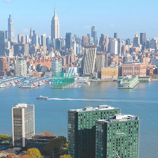
We devise globally-applicable solutions to critical infrastructure and urban systems problems in and around New York Harbor. Our resilience projects are designed to change the status quo.

Academic Programs
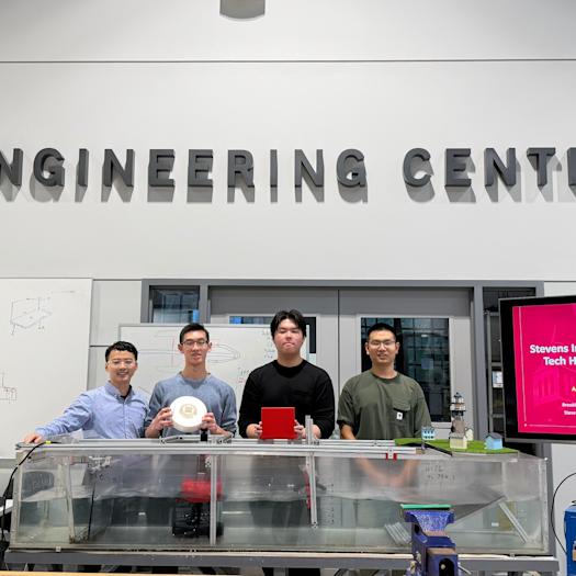
Davidson Laboratory has a long tradition of collaborative research endeavors between students, faculty and industry that create new technologies to address societal and environmental challenges.
 Muhammad Hajj, Director
The Davidson Laboratory is directed by Department of Civil, Environmental and Ocean Engineering Chair and George Meade Bond Professor Muhammad Hajj. For inquiries about collaboration with our research contact: [email protected]

Urban & Coastal Resilience
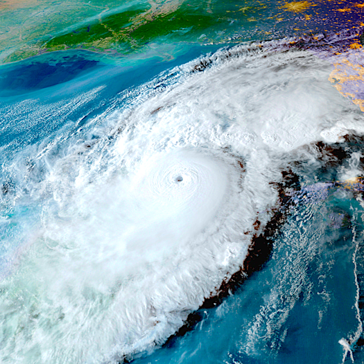
The Davidson Laboratory develops key flood, storm-surge and ocean monitoring and prediction systems used daily by the U.S. Coast Guard, Port Authority of NY & NJ and others. Watch experts explain how critical the Davidson Lab is to helping save lives and prepare communities for extreme weather and climate change.
Urban Ocean Observatory Forecasting Systems
Davidson Laboratory is home to the Urban Ocean Observatory, which hosts state-of-the-art forecasting and flood advisory systems for the New York and New Jersey area.
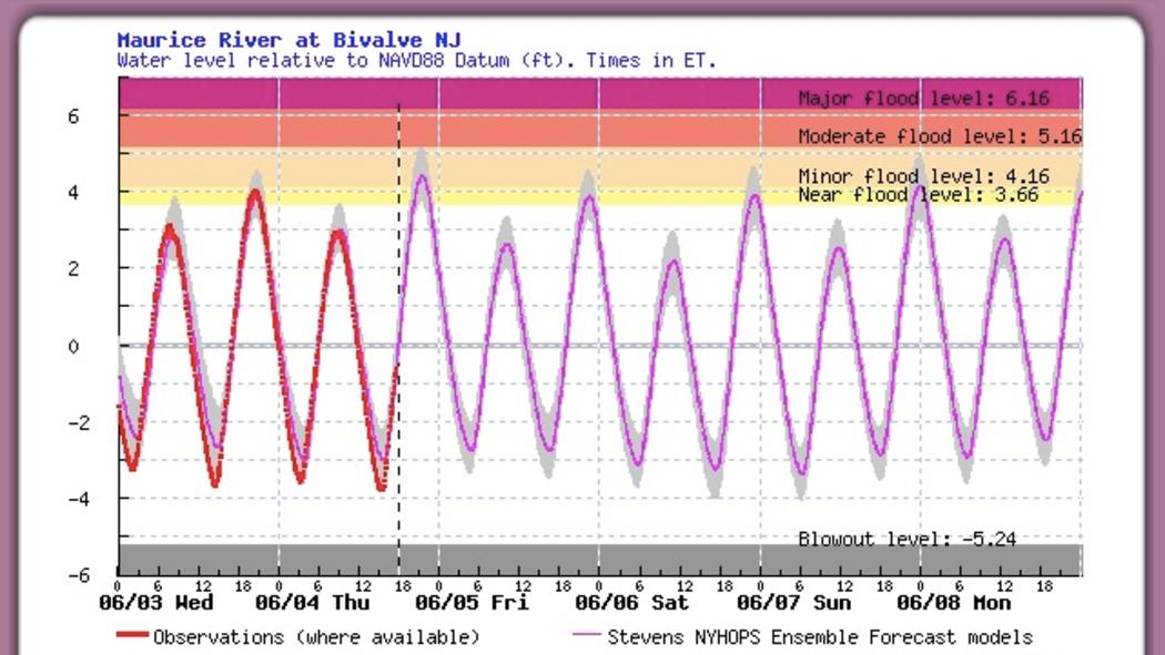
Stevens Flood Advisory System
The Stevens Flood Advisory System provides both real-time water level and forecasted water levels for 150 locations ranging from Delaware Bay north to Maine. For each location for provide present real-time water levels for observing stations (run by NOS, USGS and the PANYNJ), and forecasts water level and flooding for the ensuing four and half days. The water level and flood forecasts utilize the NYHOPS hydrological model and incorporate meteorological forecasts from the GFS, NAM, CMC and European models. SFAS allows user registration for email notification of impending flood forecasts for user-selected stations.
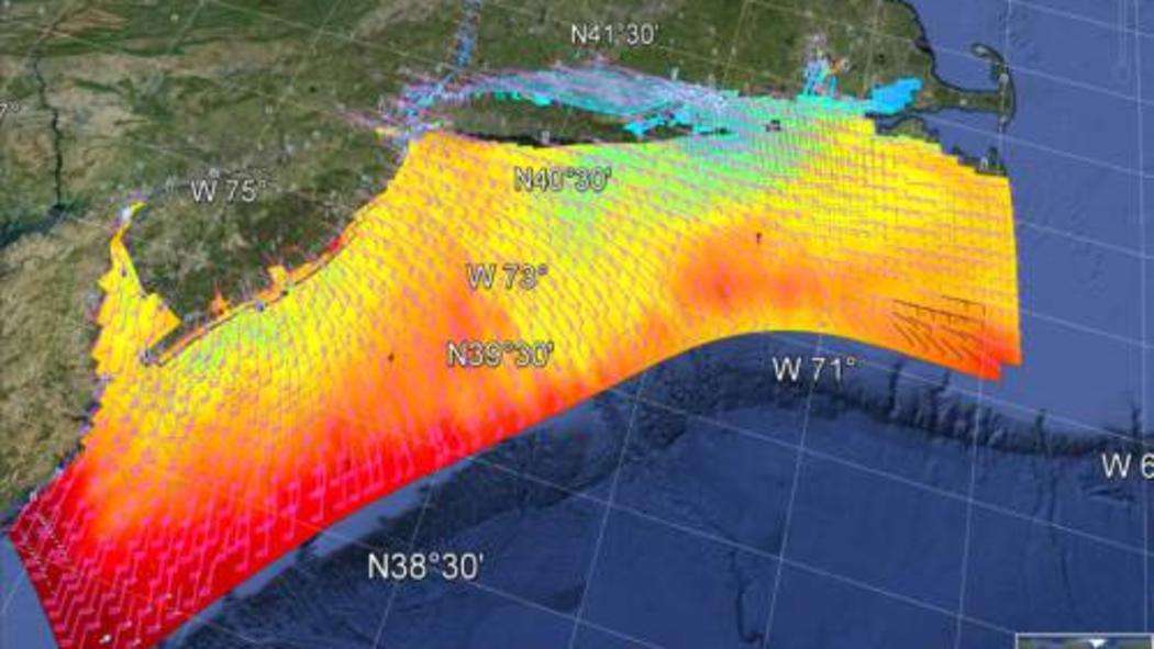
New York Harbor Observing and Prediction System
The New York Harbor Observing and Prediction System provides maritime hydrological forecasts for an area centered on the New York Harbor ranging from the Delaware bay to Cape Cod. It provides bother meteorological and hydrological forecasts for 72, in support of commercial and recreational users, and includes forecasts for data such as water current speed and direction, surface temperature, and water levels.
In the Media
READ: Proposing Solutions for Jamaica Bay
Dr. Philip Orton submitted research which argues that plans to build storm surge barriers in Jamaica Bay to protect against flooding could disrupt the bay's ecosystem and exacerbate flooding problems.
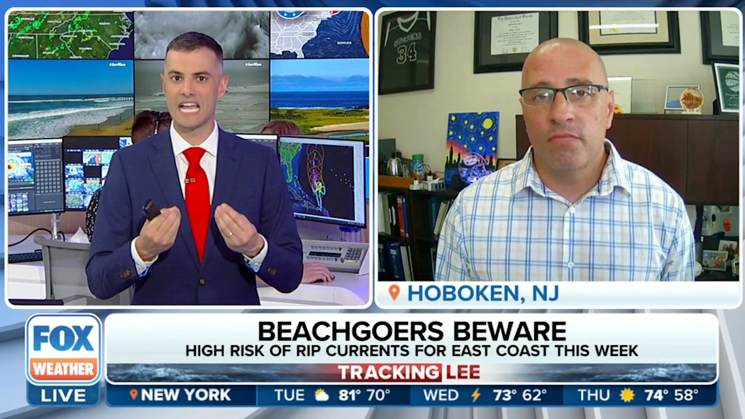
WATCH: The effects of beach erosion
Research Associate Professor at Stevens Institute of Technology, Dr. Jon Miller, joined FOX Weather to discuss the risk and forecasting of riptides.
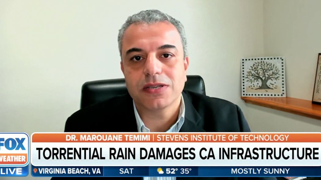
WATCH: Extreme weather hits California infrastructure
Dr. Marouane Temimi joined Fox Weather to discuss the severe weather in California and how going from extreme drought to sudden torrential downpours affects infrastructure.
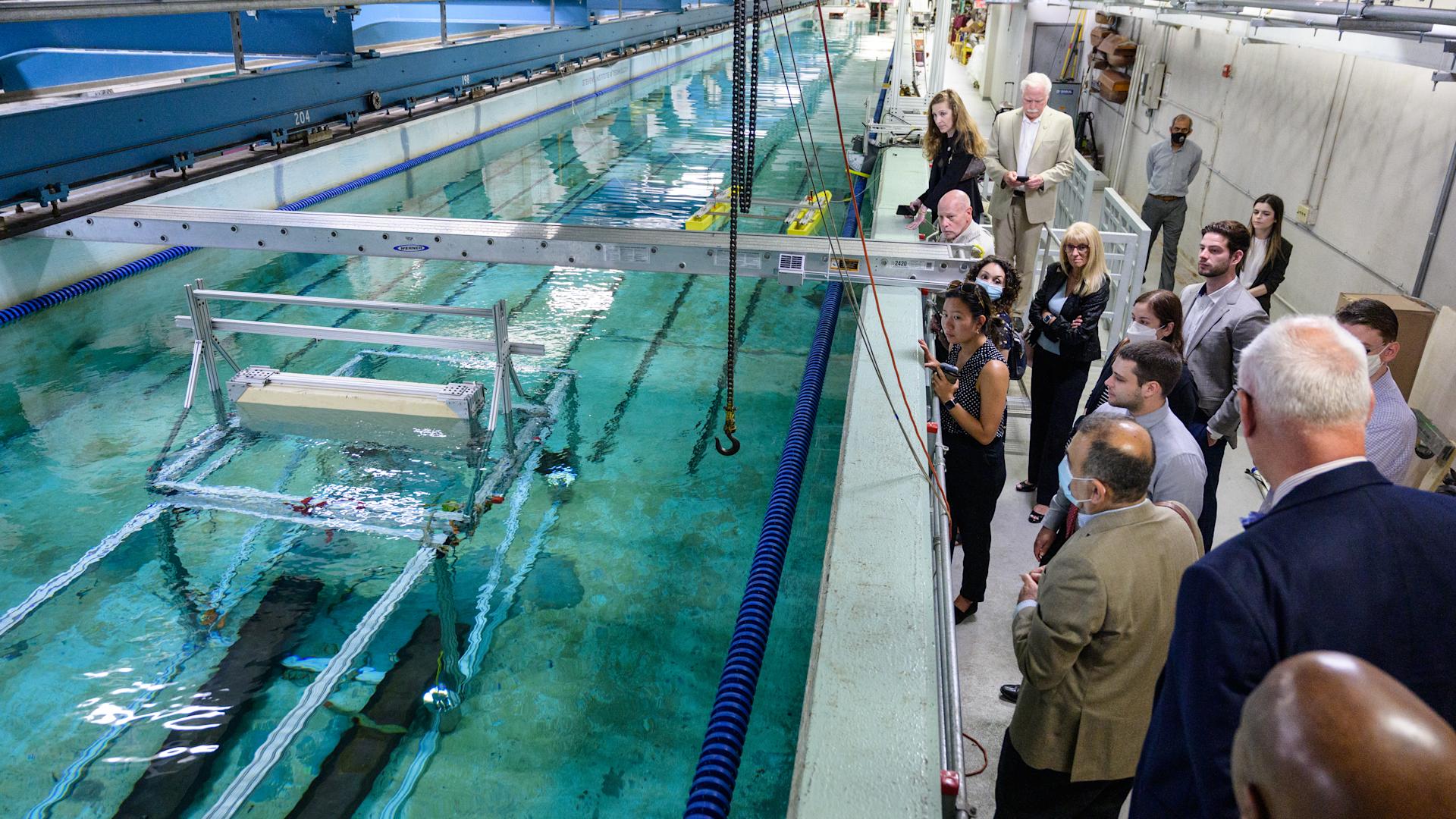
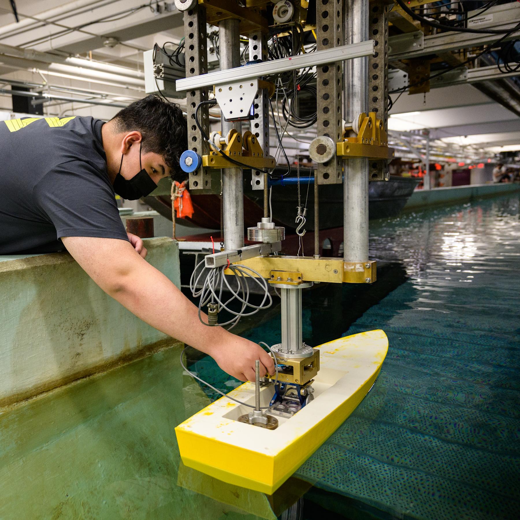
The Davidson Laboratory
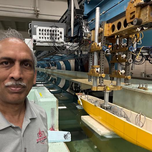
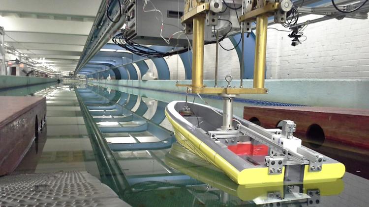
For more than 80 years, the Davidson Laboratory has delivered new knowledge and advanced technologies that support forecasting for extreme weather events, coastal resilience and marine hydrodynamics. Beginning as one of the nation’s first and most renowned hydrodynamics laboratories, the Davidson Laboratory uniquely integrates the fields of naval architecture, coastal and ocean engineering, physical oceanography, marine hydrodynamics and maritime systems. The state-of-the-art facility is home to a unique, high-speed towing tank that is the world’s fastest for its size. It can support test speeds of up to 60 feet per second and generate two-foot waves. These capabilities are used to test ship hulls for resistance and seakeeping, underwater vehicles, wave and tidal energy systems, and innovative shore protection structures.
Partner With Us
Working frequently with government agencies, the Davidson Lab is one of the most unique, widely-renowned hydrodynamic and ocean engineering research facilities in the nation.